Geography and area of Thailand
The official name of Thailand is the Kingdom of Thailand. The country occupies an area of
513,115 square kilometers. It is the world’s 50th largest country and the third largest
country in Southeast Asia, after Indonesia and Myanmar. Thailand has borders connecting with
neighboring countries:
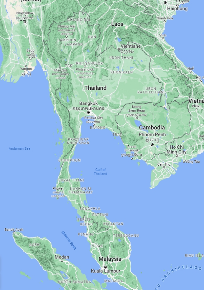
- It borders Myanmar and Laos to the north
- It borders Laos and Cambodia to the east
- It borders Malaysia and the Gulf of Thailand to the south
- It borders Myanmar and the Andaman Sea to the west
Thailand has different types of geography. It is divided into six regions and each region
has a different characteristic geography:
- The northern region is full of mountain ranges. Doi Inthanon is the country’s highest peak. It is covered with evergreen forests and is an important source of water for the country
- The northeast region consists of plateaus. The soil is dry and not always suitable for cultivation
- The central region is rich in river basins. There are two rivers, the Ping River and Yom River, which merge at Pak Nam Pho, Nakhon Sawan province, to form the Chao Phraya River, making the central region the most fertile in the country. The central region is considered one of the more significant areas in the world for rice cultivation
- The western region is full of valleys and mountain ranges, extending from the North. Important mountain ranges are the Thongchai and Tanaosri ranges
- The East is characterized by plateaus alternating with short mountain ranges. It has a smooth, long, and curved coastline. The Chanthaburi mountain range, on the east coast, forms a westward continuation of the Banthat range and forms the boundary between Thailand and Cambodia
- The South has plateaus with two great seas on both sides. The narrowest part of the country is Kor Kod Kra, connected to the Malay Peninsula